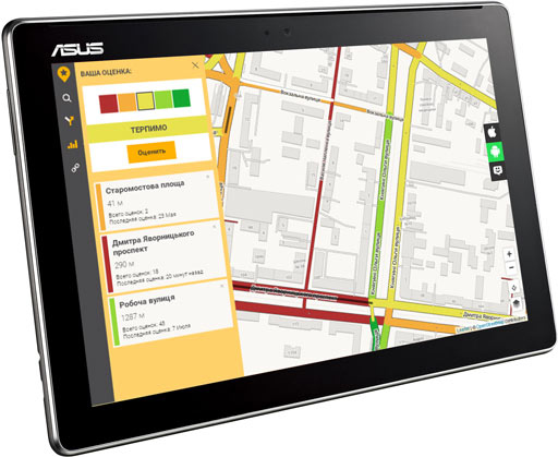
The best navigation apps for Android without the Internet. Navigators for Android
Good afternoon, dear readers! It's the 21st century, smoothly flowing into the 22nd, just the time when technology literally saves. Gone are the days when navigators were installed in cars as a separate device. Now almost everyone has an Android smartphone, which can be safely installed from Play Market any of the proposed navigators. If you ride in a taxi, pay attention to what the drivers use to take you to your destination. Precisely a smartphone. Navigators for Android smartphones are gaining popularity every day.
Let's try in today's article to determine the best navigator for Android in 2019. They all have their pros and cons. What functions should it really have? good navigator in your opinion? Answer the question and move on...
In addition to specialized navigators for Android, the review also includes digital maps, the functionality of which includes a navigator. You shouldn’t write them off, because they are very good. And plus, if you have certain cards installed, then you will not have to install any additional programs. You are ready to travel!
How to choose a good navigator for your car?
What qualities a good navigator should have depends, first of all, on your preferences. After all, some people need their navigator to work offline, while others, on the contrary, see an advantage for themselves in online navigators. Some people are looking for software that is cheaper or even free, while others, on the contrary, are willing to pay for good service. The third person will give preference to pleasant 3D graphics to the detriment of the accuracy of the maps. And so on, do you see what I'm getting at?
What is the advantage of using an Android navigator?
Judge for yourself, before, when buying a navigator, you would also have to pay attention to technical specifications devices. And if you made a mistake with your choice, you would have to change the product. Or sell it as used and buy a new one, better quality and more suitable for you personally.
With Android navigators everything is much simpler. If you don't like the navigator, you delete it and install another one. And the power of modern Android smartphones is now quite enough to cope with the most resource-demanding navigators.
Comparative table of navigators for Android phones 2018-2019.
| Offline mode | For free | Traffic jams | Voice assistant | Voice control | 3D maps | |
| Google Maps | There is | Yes | shows | There is | There is | + |
| Yandex Navigator | maps, no routes | Yes | shows | There is | There is | + |
| Navitel | There is | No | shows | There is | No | + |
| 2GIS | There is | Yes | Not in all cities | There is | No | + |
| MapFactor | There is ( online mode no at all) | Yes | No | There is | No | + |
| Waze | available in Russia | Yes | shows | There is | There is | + |
| 7 roads | There is | Yes | No | There is | No | + |
| HERE Maps | There is | Yes | shows | There is | No | + |
| MAPS.ME | There is | Yes | No | There is | No | + |
| ROUTE 66 | There is | Yes | There is | + | ||
| OsmAnd | There is | No | only when working with Yandex maps | There is | No | — |
| CoPilot GPS | There is | +/- | shows | In paid version | In paid version | |
| Navigon | There is | No | shows | + | ||
| Sygic GPS | There is | +/- | yes, even offline (statistics and forecast) | There is | No | + |
Voting for the best navigator for Android
The rest of the article presents the most popular navigators for Android devices with brief description for each. If you have already worked with any of them, you can leave a review. In the meantime, I suggest experienced drivers, racers and aces hold a small vote for the best and most convenient navigator. You can select several options, but no more than 3.
Google Maps

Google Maps navigator
The giant Google corporation, of course, primarily specializes in Internet search, but this does not prevent it from creating excellent products in other areas. A striking example of such a product is Google Maps with GPS navigation and the ability to plot a route using different types of transport. Needless to say, Google Maps is one of the most best systems for navigation on Android?
It is noteworthy that Google Maps is installed by default in almost all modern smartphones based on the Android OS.
Can work both with the Internet and without the Internet. Viewed maps and territories are simply cached in your phone's memory and can then be used if you do not have mobile internet, but not nearby WI-FI points. But it's important that The caching function can be disabled if you don't need it.
Google Maps contains maps of almost all countries of the world (including maps for Russia), which, of course, is a significant plus for those who like to travel. Wherever you go, you will be able to navigate the area, and you will not have to additionally install any local navigators.
Yandex Navigator

Yandex Navigator
Yandex, as you know, is also a search giant and occupies a leading position in the Russian Internet. Many Russians believe that Yandex Navigator is the best navigator for Android in Russia, given its capabilities.
Considering the origin of the development, it is not surprising that Yandex navigator lays out the most accurate routes across Russia. Moreover, he lays out routes, taking into account traffic jams, road repairs, accidents and toll roads. Surprisingly smart navigator, isn't it?
Yandex Navigator has one more feature - voice control. To activate, you just need to say “Listen, Yandex!” and ask for directions to the desired point. For drivers, this is just a fairy tale, given that their hands are almost always full.
On the map you can see useful places to eat, where to refuel, local attractions and more.
Unfortunately, there is a drawback. Without the Internet, you will not be able to get directions. But the map will remain available to you, so you can somehow get to the right place.
Navitel

Navigator Navitel
Navitel is one of the first and best navigators that works without the Internet. Managed to establish itself among regular users (for example, taxi drivers). However, this is a paid navigator. After installation, you receive a free trial period of 7 days, during which all cities in all 64 countries with which Navitel works are available for you to navigate. After the trial week expires, you will have to buy maps of cities or countries. Therefore, the Navitel navigator is better suited for those people who need navigation within one city, it’s cheaper.
You should also not forget that although Navitel is the best navigator without the Internet, you can only find out the state of traffic jams and weather conditions along the route if you have an Internet connection. After all, you can’t live without the Internet now! Also, without the Internet, you will not be able to update to the latest maps, and believe me, they can change over time.
The SpeedCam feature will alert you to nearby radars, highway patrol posts, speed bumps and road cameras. Well, how do you like the bonus? Navitel rightfully deserves the title of the best navigator for Android without the Internet. If only it were free...
Navigator 2GIS

2GIS navigator
This navigator is most popular among users of Apple products, although it is also rapidly gaining popularity on Android phones.
Offline navigation is available. 2GIS also boasts a huge database of enterprises marked on maps. Large shopping centers have detailed plan each floor with the names of shops and other establishments.
The information base of enterprises is constantly up-to-date, because they call enterprises periodically and ask if anything has changed. I personally witnessed this, so these are not rumors!
If you are from a small town or village, then there is a chance that you will not find your locality on 2GIS maps.
MapFactor

This free navigator for Android works offline with OpenStreetMap maps. Maps are updated every month. However, due to its offline nature, you will not see any information about traffic jams or accidents on the roads on the maps. But information about cameras on the roads is available and updated every month.
Has an overspeed control function.
Can work in car mode and pedestrian mode.
Waze - social navigator in Russia

Waze may be a unique navigator, and here's why. Essentially, Waze is a social network for motorists that is used by millions of people. There is integration with Facebook for easy login and communication with friends.
All information about traffic jams, road conditions, and gasoline prices at certain gas stations is added by users like you. And you can share with everyone too useful information, while earning points and improving your motorist rating. It easily functions without the Internet in Russia, however, as you understand, the relevance of the data will suffer.
If you stand still for a long time, the navigator will automatically close. This is done to save your battery power, which Waze drains very quickly when active work. Another drawback is that many houses are not numbered.
But an undeniable advantage is that Waze can automatically rearrange the route depending on changing traffic situations. But this only works online.
7 roads

Another free navigator for Android, working with OpenStreetMap and without the Internet. You will most likely enjoy the convenient and intuitive tiled interface (like in Windows 8/10).
A significant drawback of “7 roads” is the inability to track traffic jams and current conditions on the roads, for example, accidents. However, developers are working to solve this problem.
Another minor drawback is that city maps work as if independently of each other. Although there is general map countries (for example, navigation in Russia), when building routes from one city to another, small errors are possible, which are automatically corrected when crossing the boundaries of city maps.
HERE Maps

There was a time when this navigator only worked with Nokia smartphones. But, fortunately, it was able to develop and now HERE Maps is available for all Android devices and can please you with free navigation throughout Russia and without the Internet. By the way, HERE Maps works not only with Russian maps, but with 100+ countries around the world.
Useful places and establishments such as restaurants, cafes, etc. are marked on the maps. Some shopping centers have a detailed plan of each floor, like 2GIS.
When using HERE Maps, you can use other smartphone applications, and the voice assistant background will always inform you in time about upcoming turns and other important information.
It is also possible to share your location with friends, as well as track their location on maps.
To work without the Internet, you need to download maps to your phone in advance. In this case, all functionality will work fully.
MAPS.ME – offline maps

It is not surprising that this application is included in the world top of the best navigators for Android. The maps of this navigator are updated almost every day. Anyone can enter information about new objects that have appeared in the city, for example, public gardens, parks, fountains, buildings, etc. After this, the information is verified and the maps are updated. Thanks to this, the number of additional alternative routes and the ability to choose the shortest one are constantly increasing.
A distinctive feature of the MAPS.ME android navigator is good job in offline mode with highly detailed terrain. But this is also its disadvantage - cards take up a lot of memory in your Android device. You have to pay for the service, in this case memory.
Here's a fly in the ointment. There is no information about traffic jams.
ROUTE 66 Navigate

ROUTE 66 Navigate
Unlike other navigators for Android, ROUTE 66 uses TomTom maps, which are highly accurate and are most often installed in premium cars from the world's leading auto manufacturers.

ROUTE 66 - Follow Me
Another significant feature of the ROUTE 66 Navigate is their signature “Follow Me” feature. Follow Me is powered by augmented reality and can display the route your companion has taken in real time. This feature will be very useful if you were driving behind your partner and for some reason fell behind him and lost sight of him.
Navizor – quality of roads
A promising Russian development designed to help motorists save their cars from bad Russian roads. This is a very relevant application for Russia, and it would be wrong not to mention it.
The essence of Navizor is that users leave ratings for the roads they drive along. And all this is marked on the maps. When planning a route, Navizor takes into account the condition of the roads and will take you further away from trouble.
If you haven’t planned any route, then simply approaching roads of poor quality, you will hear a warning beep as if hinting that it is better not to go there if you value your suspension and wheels.
OsmAnd

OsmAnd is perhaps the best navigator for Android without the Internet. Distinctive feature its very good work with offline maps. At the same time, it can work with both OpenStreetMap and Yandex and Google maps and many other popular maps.
The maps show attractions and simply useful places, such as restaurants, cafes, cinemas and more.
It copes well with routing in mountainous areas, which is also an advantage for tourists and travelers.
Alas, OsmAnd is one of the few modern navigators that only works with 2D maps.
CoPilot GPS

CoPilot GPS does not need internet to work. He only uses the Internet for updates about once a month.
There is a walk mode, during which all small pedestrian paths and buildings are indicated on the map. Wikipedia is built into the application.
CoPilot GPS also has integration with popular social networks, so you can share your location with friends and acquaintances.
When planning a route, he will always offer you a choice of 3 possible routes.
Navigon

Navigon can also be considered one of the best navigators for Android without the Internet, given its history and prestige. The fact is that this application was developed by Garmin, a company that was one of the first to develop physical GPS navigators in its time. Now, with rapidly progressing digital technologies, the company decided to keep up and released its application for Android smartphones.
Considering the company’s experience, it is not at all surprising that the application turned out to be excellent and copes with laying routes in offline mode almost flawlessly.
Its main drawback is, perhaps, that the program is paid. But, judging by user reviews, it pays for its price, because it contains all the most useful features for drivers, for example, information about traffic cameras, speeding in certain areas, and more.
Through the program you can also communicate with friends and exchange your coordinates.
Sygic GPS Navigation & Maps

Sygic GPS Navigation
Definitely one of the best navigators for Android. Sygic GPS Navigation has a number of advantages, which would be better listed in a list for better understanding.
- They were developed by TomTom itself. This means the maps will be very accurate.
- Almost all maps are presented in 3D graphics.
- Basic functions work even in the free version.
- Voice guidance differs from others in that it provides information not only about turns, but also about the streets you are driving along, about attractions, and so on.
- The maps display information about cameras, traffic jams and road posts.
- Parking lots are also marked on the maps ( free seats and prices), hotels, shopping centers, gas stations, etc...
- Connect with friends (online only).
- Can be integrated via BlueTooth with a car radio.
It’s a solid list of advantages of this navigator, isn’t it? Here is another contender in the category “The best navigator for Android without the Internet” in Russia and beyond.
Conclusion:
This article does not describe all the navigators available in the Play Market. Obviously, making the right choice is quite difficult. But you can set some priorities for yourself and be guided by them when making your choice.
Soon you will be able to personally vote for the best navigator for Android in Russia without the Internet in 2019, so that the choice is more objective. Plus, if you notice any inaccuracies in the article, point them out and support your colleagues with up-to-date information.
Did you read to the very end?
Was this article helpful?
Not really
What exactly did you not like? Was the article incomplete or false?
Write in comments and we promise to improve!
If you have a smartphone or tablet with GPS and GLONASS support, it would be strange not to use it for navigation. And for the device to learn how to lay out routes for you, it is enough to equip it with a navigator application with maps of the area. There are quite a lot of applications of this kind, but not all of them are equally useful. We hope this article will help you choose a navigator for Android that will satisfy your needs in the most worthy way. The rating is based on the opinions of experienced drivers and travelers.
Waze
The developer positions Waze as a navigator that the Russian driving community helps develop. And, I must say, such collective support is beneficial for the application: many drivers switch to Waze from other navigators that they had previously used for years.
The program allows each traffic participant to add information to it themselves: report accidents, traffic jams, road works, traffic police ambushes, prices at gas stations and other things that may be useful to other users.

Waze features and functionality
Drivers value Waze for its up-to-date information, laconic interface, stable operation and, of course, free use. A big plus is that the program does not lose routes when Internet access is lost and automatically stops accessing GPS if not used during stops. This reduces the rate at which the battery drains.
Among the shortcomings of Waze, some users included the lack of a 3D mode and not always working correctly voice search.
Yandex.Navigator

Another free application that travelers have ranked among the top navigators for mobile devices. Contains very detailed and detailed information useful for both drivers and pedestrians who are in unfamiliar areas in Russia, Ukraine, Azerbaijan, Georgia, Belarus, Armenia, Kazakhstan, Tajikistan, Moldova and even Turkey (note to tourists).

Features of Yandex.Navigator
- Construction of up to three route options to a given object, taking into account traffic jams and other road events.
- Warning about toll roads and ferry crossings.
- Displays the number of kilometers left to travel to the final destination, as well as the remaining time until arrival.
- Voice accompaniment of the trip with notifications about maneuvers, speed limits, road events, radars and traffic police crews, etc. Displaying them in the form of symbols on the map.
- Driver warning about speeding.
- Voice control. The option is designed much better than in Waze. By activating control of the “Listen, Yandex” command, you can request a route to a desired point or search for an object on the map.
- Reporting information about traffic events to the program, including by voice.
- Storing the history of trips and routes.
- Search for parking lots (all - only in Moscow within the Third Ring Road; in other places of the capital and some large cities - St. Petersburg, Kazan, Kyiv, Minsk, Nizhny Novgorod, etc., separate large parking lots are displayed).
The best thing that, according to users, Yandex.Navigator has is the coverage of a large territory (especially convenient for those who travel a lot in Russia and neighboring countries) and the ability to control without hands. Disadvantages: maps are not always up-to-date, especially in regions remote from the center and small towns. And also that the program takes up too much space in the device’s memory due to the inability to move cards to removable media.

Despite the fact that it is a paid application (the cost of content starts from 560 rubles), it is preferred by more than 20 million users around the world. After all, this is, in fact, the standard by which developers of other navigation programs are compared. Among its analogues, it has perhaps the largest range of functions, and there is no driver who would say that Navitel’s capabilities are not enough for him.

A short list of functions and features of Navitel
If you install Navitel from the store Google Play, he will be tied to yours account Google, not to the device. Thanks to this, you can use the program on different gadgets.
The most strengths Navitel, according to drivers, is rich in functionality, always up-to-date information, a large selection of maps and technical support. The reasons for negative reviews are, as a rule, limitations of the 7-day trial version, local failures, minor inaccuracies on the maps - the same as with all similar programs.
Maps.me

Maps.me - free Android navigator with open source code from Mail.Ru Group. It also works without Internet access if you download the necessary maps in advance. Designed not only for drivers: in addition to roads, Maps.me maps contain walking and cycling tourist routes in many countries around the world.

Key features of Maps.me
- Saving mobile internet traffic and battery charge. Important for those traveling by bicycle and on foot, especially where there is no cellular coverage (for example, in the forest).
- The routes are always up to date and very detailed. Maps include features not found in other apps, as the latter are more geared toward the needs of motorists rather than pedestrians.
- On walking and cycling routes, the degrees of slope of the area are indicated - downhill or uphill.
- Users of the program, of whom there are more than 65 million worldwide, participate in the compilation of maps. And you can join their community too.
- In addition to creating routes, Maps.me helps you search for various objects on the ground. Search categories: catering outlets, hotels and hostels, ATMs, public transport stops, attractions. The search function is available both online and offline (offline).
- You can book a hotel room directly from the app (only available online through the Booking.com website).
- The program allows you to send messages to your loved ones indicating your current location. For this purpose they can be used cellular communication(SMS), social media and web messengers.
The main advantages of Maps.me, according to experienced travelers, are: free access to all functions, a large selection of maps (the latter, by the way, are well optimized for mobile devices: with the same amount of content as in other programs, they take up much less space in the gadget’s memory), as well as taking into account the needs of pedestrians and cyclists.
The application has, perhaps, only one significant drawback. Because maps are created by users, the data often contains errors. In addition, some maps are better designed than others. This again comes down to user engagement: where people are more active, the maps are more detailed and accurate. And vice versa.
Google maps, transport and navigation

is another free and widely available Android navigation app. Used and supported by perhaps the world's most impressive user community. Helps you navigate unfamiliar terrain and plan a route for travel in almost any locality on the globe.

Features of Google.Maps
- Quickly build routes taking into account the situation on the road. If obstacles appear - traffic jams, accidents, etc., the route is automatically rebuilt. Automatic selection of the least congested lane.
- Dynamic POI.
- The ability to quickly obtain information about objects of interest in the area, for example, catering outlets. Information about the latter may include user ratings, interior photos, reviews, opening hours, prices, menus, etc.
- The opportunity to leave reviews about the places you visit.
- Always up-to-date information on public transport routes.
- Unique feature: displays the interior layouts of large public buildings: shopping centers, train stations, airports and stadiums, which helps visitors not get lost in them.
- Description of more than 100 million objects around the world, as well as more than 220 regions and countries.
Travelers value Google maps primarily for its simplicity, accessibility and convenience. And many people called the strange experiments of the developers, such as the integration of the Pac-Man game into the program, as shortcomings, or rather, excesses, which only distracts the driver while driving and does not carry anything useful.
Good afternoon everyone!
I think that everyone who often travels by car (especially in an unfamiliar part of the city, or even when going on vacation or traveling) often faces the problem of orientation: where is the best road, which one is shorter, is it possible to drive directly, are there any traffic jams? etc. This is only a small part of the issues that can be solved with the help of modern GPS navigators .
Today, the choice of programs (applications) for navigation is huge! And different products differ not only in functionality, but also in their approach to solving the problem (for example, one navigator will tell you that there is a shorter road, but another will not even warn you about it until you ask it). So making a choice is not so easy, and that is why I decided to write this note.
By the way, I would like to immediately answer one popular question: “Why do I need navigators at all, I have online maps* from Yandex/Google on Android?”. (*not to be confused with the navigation apps they also have)
Firstly, these products only work online. Now imagine if you find yourself in a place where there is no Internet connection (and this can easily happen on the road)? That's it! And the navigator has offline operating mode: he’s unlikely to warn you about rain there, but he’ll definitely tell you about road repairs and the shortest route!
Secondly, navigation applications have much greater functionality and ease of use (there are various auto modes that are ways to control all aspects that may affect you on the road (even refueling the car)).
Thirdly, as a rule, applications have much more accurate maps. In large cities this is hardly noticeable (both there and there - everything is accurate), but as soon as you find yourself outside the metropolis, the difference will catch your eye.
Fourthly, you can combine the work of Yandex and Google maps with the readings of navigator programs. As you know, the truth is somewhere in the middle.
Navitel Navigator GPS & Maps

Screenshots of Navitel Navigator (from the official website)
Probably one of the most famous navigators (more than 20 million users all over the world)! Offline maps are supported for large quantity countries (Russia, Ukraine, Belarus, Azerbaijan, Austria, etc., there are more than 60 of them!).
I note that the program is able to control almost everything that surrounds you on the road: the weather, road repairs, gasoline prices, cafe opening hours, the movements of your friends, estimated travel time, etc. A mega-useful thing for all those who like to explore little-known roads!
Peculiarities:
- all maps are available offline: i.e. no matter where you are, you will always know where to go;
- maps can be loaded into the device memory or onto an SD card;
- the ability to exchange messages with friends, plot a route to intersect with them on the way;
- traffic jams: the application will warn you about the best route (monitors traffic jams in real time);
- the ability to predict the weather 3 days in advance;
- useful information: fuel prices (at gas stations in the area), opening hours of restaurants, cafes, etc. (very useful on the go, helps save money);
- control over road works, speed cameras, speed bumps, etc. (will warn you about everything in advance);
- support for 3D maps;
- the ability to use voice prompts (just like in a rally!);
- on-board computer: control of speed, temperature, weather conditions, etc.;
- laying out several routes (taking into account different conditions) - you can choose the most optimal one;
- GPS/GLONASS.
Yandex.Navigator

A product from the most famous search engine and company in our country. It is distinguished, first of all, by the presence of the most convenient voice assistant“Alice” (which is a huge plus, because it’s faster and more convenient to control with your voice when you’re driving). She can answer most of your questions: for example, she can build a road home, tell you about the weather, gas prices, etc.
The rest of the functions are quite standard: road control, offline operation mode, laying out several routes, warnings about traffic jams, accidents, etc.
Peculiarities:
- the application contains maps of the following countries: Russia, Azerbaijan, Armenia, Belarus, Abkhazia, Georgia, Kyrgyzstan, Moldova, Kazakhstan, Tajikistan, Ukraine, Turkey, Uzbekistan.
- Voice control using "Alice" (it's very convenient)! Imagine, you can ask your navigator by voice to show the way home, or ask what the temperature is outside the window, what the weather forecast is, what the fine is for exceeding it, etc.
- The navigator is able to show the route taking into account traffic jams, repair work, and accidents. The application also warns about toll roads and shows alternative routes (if available);
- the ability to plot routes offline;
- during the entire journey, the application can warn you about speed cameras, speed bumps, traffic jams, how and where it is better to turn to save time;
- the navigator controls your speed: if you exceed it on this section of the road, the program will warn you about it;
- The navigator saves the history of your movements (later you can quickly build a route by specifying already visited points).
PROTOWN

This application helps not only to build and navigate the shortest route, but also to save money on the road. It knows where gasoline is sold at discounts, where what promotions are, where it can turn down. In addition, the Progorod application has partnership agreements with many organizations, which means you will receive discounts on fuel, spare parts, maintenance, etc. (where others will pay the full price!).
I would like to note that the application is rapidly gaining popularity: it is already used by more than a million drivers in our country alone!
Peculiarities:
- maps of most countries are available: Russia, Ukraine, Kazakhstan, USA, Latvia, Lithuania, Belarus, etc. (almost all of Europe and America);
- construction of three directions of the route (both online and offline). When constructing, you can specify intermediate points (i.e. those places that you definitely want to pass);
- opportunity voice input information;
- daily map updates;
- warning about road features: speed bumps, speed limits, pavement repairs, etc.;
- the ability to view the road and terrain in 3D mode;
- the ability to easily and quickly search for shops, cafes, gas stations, etc.;
- the ability to record online traffic and weather conditions;
- possibility of a free call to the service emergency assistance in case of an accident;
- You can even control the application using gestures!
CityGuide (CityGID)

A very interesting navigator that contains both paid and free cards. Many countries are supported: Russia, Ukraine, Kazakhstan, Belarus, Georgia, Finland, etc.
"CityGuide" allows you to work with maps both with and without the Internet. The user-friendly interface and well-developed operating algorithm of the application allow it to be used even in the harshest conditions...
Peculiarities:
- daily map updates: i.e. you will always know where repair work is going on, where accidents occurred, where it is better not to turn...;
- the patented "Traffic 2" algorithm for constructing a route allows you to choose the least time-consuming road;
- the application “knows” and takes into account the operation of crossings, bridges, toll roads, etc. ( approx. : many navigators do not take this information into account);
- one of the best optimized engines for working with maps: very smooth movement and movement on the map, support for hardware acceleration, quick route building (with virtually no “thinking”);
- You can work with all maps in the application without an Internet connection;
- walkie-talkie: the ability to communicate through the navigator with other users;
- when you add friends to your favorites: you will always see where they are on the map, you can plan a trip together;
- the ability to quickly call an equator, taxi, emergency services, etc. It can be very helpful on the road, for example, if a breakdown occurs...
Google Maps (Maps: navigation and public transport)

Screenshots of Google maps (from the developers)
A universal application from Google: millions of users use it not only on navigators, but also on regular phones. The application knows about roads in 220 countries of the world! In addition, Google Maps knows everything in the area and can report on: road congestion (where are traffic jams, where are repairs), will find the fastest mode of transport to move from point A to point B, will tell you where the nearest cafe or restaurant is, recommend city attractions ( district), and much more.
Peculiarities:
- support for hundreds of countries (the widest geography of use);
- It’s easy to get a route from one point to another: Google will show you how to get there by car, how you can get there by bus, plane and train (if the distance is expensive). Moreover, it will calculate the approximate travel time and where you can get tickets (very convenient!);
- it’s easy to find interesting places: both in your city and somewhere else;
- the ability to create lists of your favorite places and share them with friends;
- support for cards to work without an Internet connection;
- it is possible to look at photos of restaurants, cafes, museums without visiting them (not for all organizations);
- the ability to view the route (streets, roads, etc.) in 3D mode, i.e. the way it looks in real life;
- constructing diagrams of airport buildings, stadiums and other large premises.
OsmAnd

The application is aimed primarily at autonomous operation- i.e. Without access to the Internet, you can find your way in an unfamiliar area, find out about objects on the map (gas stations, cafes, hotels), see the sights and much more.
The application supports maps of many countries: Russia, Ukraine, Belarus, Kazakhstan, etc.
Peculiarities:
iGO Navigation

Quite a popular application (especially abroad). Allows you to travel throughout Europe, America and Asia without having any extras. kart! The application is able to work autonomously, and it is also very undemanding of memory (according to the developers, approximately 2 times less memory is required on the device to operate iGO Navigation (compared to other similar products)).
Peculiarities:
- support for terrain maps of 100 countries! (Russia, Ukraine, Germany, Italy, France, Türkiye, etc.);
- low device memory requirements (about 1.5-2 times compared to other similar applications);
- several options for constructing a route ( best option you can choose yourself based on your requirements);
- a large database of cafes, restaurants, gas stations and other attractions;
- the ability to view 3D models of cities and streets;
- stable work in offline mode (without access to the Internet);
- there is a sound indicator function (it will tell you how to drive along the chosen route);
- helps you find a house and a street even in places where the house numbers are not sequential (approx. : in Russia there is confusion with even and odd house numbers) .
By the way, if you are “lost” or miss your friends or relatives in an unfamiliar city, I recommend one of my previous articles:
"How to show others your location if you don’t know the address (search by coordinates). How to find the right address in an unfamiliar city" -
Good orientation to the area everyone!
This is one of the best offline navigation apps. From version to version, new functions appear in it, and today it can lay out ordinary and pedestrian routes, has highly detailed maps and excellent operating speed. The application is completely free and does not contain any restrictions on the number of maps you can download - you can download the whole world if your smartphone’s storage capacity allows it.

OsmAnd
In this application, the source of map information is the OpenStreetMap project, which exists and is filled with data thanks to the help of thousands of volunteers from around the world. The usefulness of this application may depend on the place where it is used, since in some regions it knows the location of literally every object, even shops and monuments, while in others it has difficulty displaying only the main streets. Free version allows you to download maps for ten different countries, which is quite enough in most cases. Some additional features implemented in OsmAnd using plugins, which also need to be downloaded separately. Overall, OsmAnd is a powerful application with a lot of features, but with a somewhat confusing interface.

City Maps 2Go
This app's maps and data are stored on your device, so you can access them at any time, including offline. All functions such as address search, reviewing and GPS location can work without Internet access. Although the map data is also drawn from the OpenStreetMap project, I found the map detail in this application to be a little less detailed than in the previous one. allows you to search for addresses, attractions, points of interest offline, but does not have a navigation function. An interesting feature of this application is the integration with Wikipedia, so you can always get additional information about the places you are interested in.

Google Maps
We can talk about the main mapping application for Android for a very long time, since it has a huge number of different functions. However, in light of this review, we're most interested in offline use. It was possible to download map sections in this application before, and more recently the developers added full-fledged navigation and search for objects without an Internet connection. So now Google Maps can be safely used abroad while roaming or in places where an Internet connection is not available.
#10 – CityGuide

CityGuide is a free navigator that will independently select a route for you, taking into account traffic jams that may occur along the way. This application will be able to work in different countries, mainly the CIS. The good news is that the maps do not stand still, but are updated every day. So you won't miss any changes on the roads.
Another benefit is that the navigation takes into account bridge and railroad crossing closure schedules. Additional features include a radar detector system, a walkie-talkie and an SOS service, with which you can call a taxi, tow truck or emergency services. In addition, the application works offline and in Russian.
Users complain that advertisements may pop up in the application during a trip.
No. 9 – OsmAnd

The OsmAnd application is able to work with maps offline if you save them in advance. There are three modes: car, bicycle and pedestrian, so the program will help not only while driving. It is possible to overlay additional translucent cards.
All maps in the service are regularly updated, and route planning is very flexible. It’s also nice to be able to see navigation around the city when using public transport. Separately, it is worth noting that the application displays the maximum permissible speed at which you can move on a particular section of the road.
Many people don’t like that the application can sometimes provide a roundabout route instead of the optimal one.
No. 8 – 2GIS: reference book and navigator

This is a very popular application that has been downloaded more than 10 million times. And this is not surprising, because the service contains in its database not only maps with optimal routes for pedestrians and cars, but also a huge number of different organizations. We are talking about shops, hospitals and establishments. So you can find the place you need to go to, even if you don't know the address.
The application allows you to download all the necessary databases to your phone so that you don’t have to connect to the Internet to find a route. The navigator is able to independently detect traffic jams. In addition, it is relevant for almost all major cities in Russia.
And again, too intrusive advertising is called a disadvantage of the service.
2GIS: directory and navigator
No. 7 – Maps.me

Maps.me features very accurate and highly detailed maps. Thanks to this, he can find any objects, even the nearest bench to sit on. It is possible to overlay a vector map as a second layer. This can be useful if you want to avoid traffic jams by using the metro.
The application setup is very flexible. You can change the unit of measurement, scaling, enable or disable voice instructions. Here you can choose your travel method – car, public transport, bicycle, taxi or on foot.
The maps in this app are created by the public, so there may be too little information available for cities with small populations.
#6 – Sygic GPS Navigation

This program For its work, it uses maps from all over the world from different suppliers, which are updated several times a year. There is very accurate and detailed voice navigation, including voicing street names. Separately, it is worth noting the presence of functions whose purpose is to increase the level of safety on the road.
There are built-in instructions for changing lanes and speed limits. These features will be especially useful for those who do not yet have much driving experience. Even more convenient is the ability to monitor available parking spaces.
Sygic GPS Navigation
The application can be used for free for only 7 days. After this you will have to pay a subscription.
No. 5 – Seven Roads

Seven Roads is distinguished by its user-friendly interface and detailed maps. The program can save routes and flexibly configure all functionality. A very nice feature is the ability to create your own maps. The application can subsequently be improved by downloading various add-ons.
Voice prompts sound pleasant and unobtrusive. Eat quick search at the address or object you need to get to. It is especially convenient that you can plot the most detailed route, even if its length is more than 10 km.
Sometimes, after updating the map, the route may not be displayed correctly. This does not happen systematically, but sometimes such a nuisance arises.
Seven Roads
#4 – Waze

Our rating of navigators for Android continues with the Waze application, which is equipped with a large number of social functions. With this program you will always be aware of traffic jams, traffic police posts, emergency situations on the road and even the placement of cameras. The maps used by Waze are highly detailed and informative.
Another convenient feature is automatic route restructuring in case the application crashes or the phone turns off unexpectedly. Plus, with Waze, you can save money; the app can find you the cheapest gas station nearby.
Unfortunately, the application is inferior to competitors because it requires the Internet to work.
No. 3 – Navitel

This application released by lead developer navigation systems and digital maps. For greater convenience, the program can switch between 2D and 3D modes. There is a convenient interface with quick access to all the necessary functions. The voice guidance here, unlike most navigators, has a natural and pleasant timbre.
The system is capable of switching between satellites, so weather conditions are not an obstacle for it. I'm pleased with the simple management of the cards; for example, you won't spend a lot of time zooming them. Overall, the application is so informative that it even displays the speed of an object on the road.
The application itself can be installed for free, but you will have to pay for maps.
#2 – Google Maps

Google Maps is a standard navigator that is installed on every Android smartphone. This leads to its first advantage - the application is completely free, you don’t need to download it, and there are no ads in it. It is also worth noting the integration with Google Assistant, which provides convenient voice search.
Initially, the application was too limited, but now it has been improved, offline maps and other features have been added. You also need to pay attention to the fact that the service takes maps from the built-in database, so you don’t have to bother installing them.
As for the disadvantages of Google Maps, it is a very limited set of locations, attractions and other objects, information about which is marked on the map.
No. 1 – Yandex.Navigator

Russian development Yandex.Navigator on at the moment leads among other navigation systems. The application is very careful about the resources of the smartphone, but provides the user with all the necessary information, including traffic density, road congestion and various incidents that may complicate the trip.
There is a well-structured interface, as well as the presence of a countdown until arrival at the destination. If on the way you stop at some establishment, gas station or car wash, the program will rearrange the route so that you still get to the place as quickly as possible.
Many people like the presence of a night mode, which makes the map and interface dark. This is not only beautiful, but also allows the driver not to be distracted at night by the bright light of the display.
Yandex.Navigator
While maps can be used offline, directions are only available when connected to the internet.
The Top navigators for Android include only the most best apps, with which you can easily find your way even in an unfamiliar city. Each program has its own advantages and disadvantages, so do not blindly rely on its place in the ranking. Choose what works best for you.


